NASA has released a new high resolution satellite image of the North Eastern region of the United States covered in over 80cm of snow.
NASA has already released satellite imagery of the continent blanketed in snow. You can see the accumulation of snow in this time lapse video.
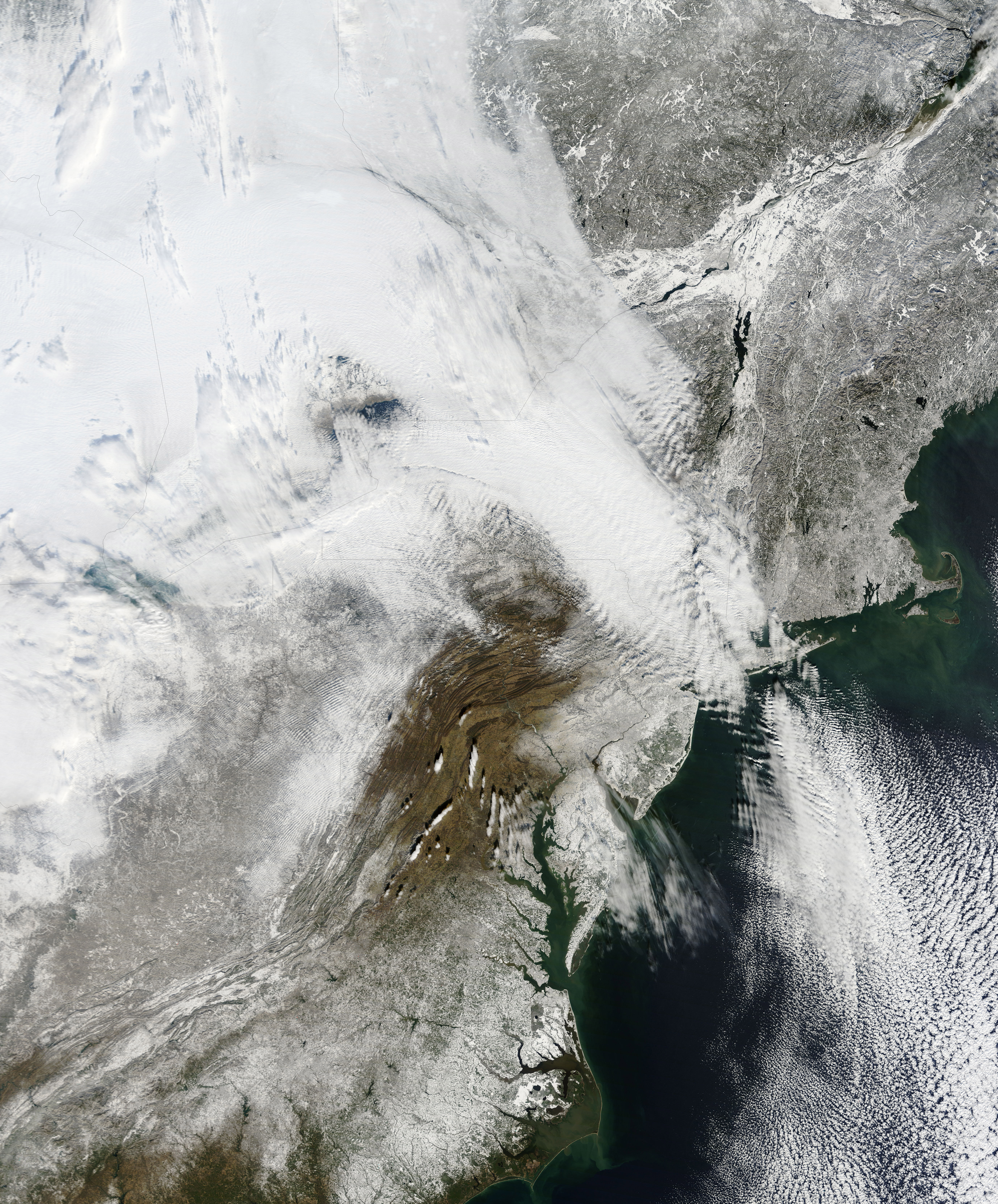
New York can be found above the darker grey area at the centre of the image.
The Moderate Resolution Imaging Spectroradiometer (MODIS) on NASAs Terra satellite captured this natural-color image of the northeastern United States and part of Canada on December 28, 2010. Snow and clouds blend rather seamlessly, but can be distinguished by their different textures. The wide swath of uniform white that extends from Michigan and Ontario toward the southeast is a cloudbank. Under clear skies, snow cover from the storm creates a mottled appearance across New England and southeastern Canada. Farther south, the snow appears to have missed much of central Pennsylvania.
NASA
The image was recorded on December 28th by NASA’s MODIS satellite.
The road to the Genesis Mission was paved by technocrats like Larry Ellison and Tony…
DPI means your digital identity will follow you everywhere — everything you do and say…
Imtiaz Mohammady, founder and CEO of global technology consulting firm Nisum, doesn’t fit the Silicon…
The birth of quantum mechanics was accidental, as most scientific discoveries go. Working from the…
The convergence of AI, specialized software, and clinical expertise is creating a new paradigm in…
The IRS just confirmed that Direct File — the agency’s short-lived attempt to offer a…
View Comments